Norikura and Utsukushigahara: Taking on a Cyclist's Mecca! Hill Climb
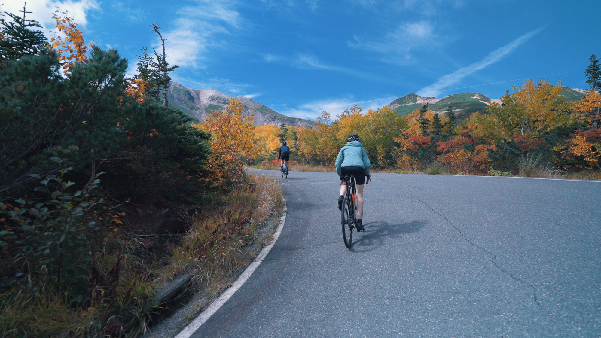
Tour de Utsukushigahara Cycling Race Route
A route with a total length of 21.6 km, an elevation gain of 1,270 m, and an average gradient of 5.9%.
The famous “Gekisaka” climb, located shortly after the start, is a challenging section; however, the thrill of tackling this climb attracts many participants from across the country.
The views of the Northern Alps and the cityscape that unfold beyond the tree line, as well as the clusters of rhododendrons just before the finish line, are truly breathtaking.
*The Utsukushigahara Forest Road, which is part of the route, is closed for the winter from around late November to mid-April every year.
Please check the forest road restrictions in advance.
Norikura Hill Climb Race Route
With a total length of 20.5 km, an elevation gain of 1,260 m, and an average gradient of 6.1%, the finish line sits at 2,720 m—the highest point of any paved road in Japan. It is truly “the bicycle road closest to the sky.” With a history spanning over 40 years
, this event has earned immense popularity among cyclists as a pioneer of hill climbs in Japan.
*National Route 158, which connects Shinsimasima Station to the Norikura Highlands and the Abo Pass (the old road continuing toward Gifu Prefecture; bicycles are not permitted through the Abo Tunnel), is narrow and features multiple tunnels. Combined with heavy traffic from large vehicles and other sources, riding a bicycle on this route is dangerous.
Therefore, we recommend using public buses or private vehicles to travel this section.
*The Prefectural Route Norikura-dake Line (Norikura Echo Line), which is part of this route, is closed to bicycles annually from November 1 through June 30.
Please check traffic restriction information in advance. You can also check traffic restriction information for National Route 158.
For information regarding the Norikura Skyline on the Gifu Prefecture side, please check the official website.
![[First-Time Matsumoto Travel Guide] A Comprehensive Guide to Matsumoto’s Charms: From Stunning Views to Hot Springs and Local Cuisine](/lsc/upfile/article/0000/0028/28_1_m.jpg)
![How to get to Matsumoto: A detailed explanation [JR/bus/plane]](/lsc/upfile/article/0000/0033/33_1_m.jpg)
![[The Gateway to the Alps] The highlights of Matsumoto City’s mountain resorts](/lsc/upfile/article/0000/0024/24_1_m.jpg)